Distance Calculator
Distance from Most to Ceska Lipa
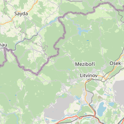
The shortest distance (air line) between Most and Ceska Lipa is 41.58mi (66.92 km)
The shortest route between Most and Ceska Lipa is 53.46 mi (86.03 km) according to the route planner. The driving time is approx. 1 h 26 m
How far is it between Most and Ceska Lipa.
Most is located in Ústecky kraj, Czechiacountry within 50° 30' 11.16" N 13° 38' 12.12" E (50.5031, 13.6367) coordinates. The local time in Most is 19:45 (16.07.2025)
Ceska Lipa is located in Liberecky kraj, Czechiacountry within 50° 41' 18.96" N 14° 32' 18.96" E (50.6886, 14.5386) coordinates. The local time in Ceska Lipa is 19:45 (16.07.2025)
The calculated flying distance from Most to Ceska Lipa is 41.58miles which is equal to 66.92 km.
If you want to go by car, the driving driving distance between Most and Ceska Lipa is 53.46 miles (86.03 km). If you ride your car with an average speef of 112 kilometers/hour (70 miles/h), travel time will be 0 hours 46 minutes.Please check the avg.speed travel time on the right for various options
Estimated Travel Time Between Most and Ceska Lipa
| Average speed | Travel Time |
|---|---|
| 30 mph (48 km/h) | 1 hours 47 minutes |
| 40 mph (64 km/h) | 1 hours 20 minutes |
| 50 mph (80 km/h) | 1 hours 4 minutes |
| 60 mph (67 km/h) | 0 hours 53 minutes |
| 70 mph (112 km/h) | 0 hours 46 minutes |
| 75 mph (120 km/h) | 0 hours 43 minutes |
Related Distances from Most
| Cities | Edite sus datos personales, tarjetas de crédito guardadas y preferencias de viaje |
|---|---|
| Most to Chomutov | 10.10 mi (16.25 km) |
| Most to Teplice | 12.99 mi (20.90 km) |
| Most to Usti nad Labem | 20.75 mi (33.40 km) |
| Most to Decin | 30.82 mi (49.61 km) |
| Most to Karlovy Vary | 38.59 mi (62.10 km) |
| Most to Ceska Lipa | 41.58 mi (66.92 km) |
| Most to Brevnov | 43.07 mi (69.31 km) |
| Most to Prague | 44.99 mi (72.41 km) |
| Most to Cheb | 63.09 mi (101.53 km) |
| Most to Liberec | 65.26 mi (105.02 km) |
| Most to Jablonec nad Nisou | 68.86 mi (110.82 km) |
| Most to Hradec Kralove | 98.89 mi (159.14 km) |
| Most to Pardubice | 99.91 mi (160.78 km) |
| Most to Znojmo | 156.79 mi (252.33 km) |
| Most to Brno | 160.38 mi (258.11 km) |
| Most to Prostejov | 169.95 mi (273.50 km) |
| Most to Olomouc | 172.19 mi (277.12 km) |
| Most to Prerov | 184.26 mi (296.53 km) |
| Most to Opava | 192.63 mi (310.02 km) |
| Most to Zlin | 199.75 mi (321.46 km) |
| Most to Ostrava | 211.11 mi (339.74 km) |
| Most to Frydek-Mistek | 216.40 mi (348.26 km) |
| Most to Havirov | 217.65 mi (350.27 km) |
| Most to Karvina | 221.62 mi (356.66 km) |
| Most to Trinec | 230.36 mi (370.73 km) |
Ceska Lipa, Liberecky kraj, Czechia
Related Distances to Ceska Lipa
| Cities | Edite sus datos personales, tarjetas de crédito guardadas y preferencias de viaje |
|---|---|
| Decin to Ceska Lipa | 16.09 mi (25.89 km) |
| Usti nad Labem to Ceska Lipa | 21.86 mi (35.18 km) |
| Liberec to Ceska Lipa | 23.72 mi (38.17 km) |
| Jablonec nad Nisou to Ceska Lipa | 27.66 mi (44.51 km) |
| Teplice to Ceska Lipa | 31.10 mi (50.05 km) |
| Most to Ceska Lipa | 41.58 mi (66.92 km) |
| Prague to Ceska Lipa | 41.85 mi (67.35 km) |
| Brevnov to Ceska Lipa | 42.57 mi (68.51 km) |
| Chomutov to Ceska Lipa | 51.68 mi (83.16 km) |
| Hradec Kralove to Ceska Lipa | 65.85 mi (105.97 km) |
| Pardubice to Ceska Lipa | 70.76 mi (113.87 km) |
| Karlovy Vary to Ceska Lipa | 79.82 mi (128.46 km) |
| Cheb to Ceska Lipa | 104.37 mi (167.97 km) |
| Brno to Ceska Lipa | 138.39 mi (222.72 km) |
| Prostejov to Ceska Lipa | 141.65 mi (227.96 km) |
| Olomouc to Ceska Lipa | 141.92 mi (228.40 km) |
| Znojmo to Ceska Lipa | 143.46 mi (230.87 km) |
| Prerov to Ceska Lipa | 154.71 mi (248.97 km) |
| Opava to Ceska Lipa | 157.28 mi (253.12 km) |
| Zlin to Ceska Lipa | 171.58 mi (276.13 km) |
| Ostrava to Ceska Lipa | 175.95 mi (283.16 km) |
| Frydek-Mistek to Ceska Lipa | 182.30 mi (293.38 km) |
| Havirov to Ceska Lipa | 182.68 mi (293.99 km) |
| Karvina to Ceska Lipa | 185.96 mi (299.28 km) |
| Trinec to Ceska Lipa | 195.75 mi (315.04 km) |


